Hiking the High Country
- Jessica Lucey

- May 14, 2018
- 5 min read
Updated: Jun 23, 2018
The first stop on the US tour brought Tom and me to Boone, a town in Western North Carolina that's home to a slew of outdoor activities that has something for everyone no matter your activity level. Located along the Blue Ridge Parkway, I was so excited to get the opportunity to hike some mountains in High Country. It was raining the entire car ride over to Boone and our first day in the city. Once it finally stopped, we took every opportunity to get outside.
Elk Knob State Park
Summit Trail~out and back~3.8 miles total~5520 ft (1682 m)
The car ride over to the park brought intermittent sprinkles, but it wasn't a big deal. We had rain gear, and I decided to take this as an opportunity to start preparing for our trip to the Netherlands since it's likely to rain at any time of day at any time in the year. As the car climbed higher and higher up the mountains, it became more and more foggy. We actually missed the sign marking the entrance of the park. You'll know you're getting close when you see a bunch of no parking signs along the road.
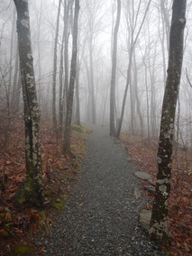
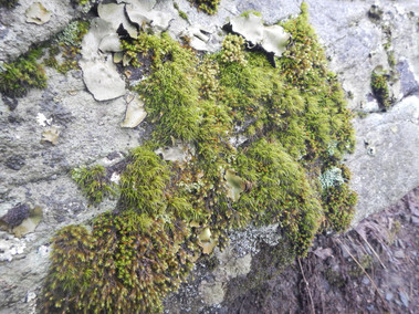
Once we found the entrance and parked the car, stepping out onto the trail felt more like being transported to Scotland: dense fog, misty rain, rocky landscape. There's nothing quite like walking through a forest in the rain. Everything smells so fresh and the environment takes on a whole different atmosphere. It was so magical being the only ones on the trail, continuously walking through the fog, and seeing something new with each every step. I was mesmerized by all the plants that had recently emerged from the ground and the old moss that had taken over. Tall trees were growing by older ones that had fallen during the last couple days of rain. As I kept walking up the path, I watch the water as it knew just which path to take for it to fall effortlessly down the side of the hill.
Elk Knob is interesting in that there are two different views to see from the top: the north side and the south side. There are signs at each end labeling the mountains that you can see. However, once we got to the top, we couldn't see more than 10 feet in front of us. The fog that we encountered coming here hadn't lessened. It's pointless being upset at missing a view, and better to bow to nature and her magic. I don't do this for the photos. I head outside to reconnect with where we came from in the first place --- to have my heart receive and get filled by the things which are not man made.
Crab Orchard Falls
out and back~1 mile total~3110 ft (948 m)
The car ride to get here took us past Mast General Store. We popped in for a quick trip back in time to see barrels full of old fashioned candies and toys, random odds and ends, a variety of local country gourmet foods, some outdoor gear, and more. They'll also be happy to point you in the right direction to the trail head if you get lost.

After some winding roads up the mountain on Hwy 194 in Valle Crucis, we reached the Church of the Holy Cross. Parking for the trail head is located on the left of the hill going up the the Valle Crucis Conference Center. (If you've reached the Inn, you've gone too far.) There was tons of parking available; but, depending on the time of year and the weather, it could get pretty packed. Between Labor Day and Thanksgiving, it can get pretty busy with the summer and color tour visitors.
The trail head starts on the path to the right of the Inn. It takes you around the back before you head up the steep path to the falls. It's no joke steep. You go from 2,785 feet to 3,110 feet in 0.4 miles. I though it would be a breeze, but after living by the coast for a year and a half where there's not much elevation gain, it was tough! There are benches along the way to use in case you get tired. They're also numbered in case anyone needed to be rescued because they were too tired to make it back to their car. (At least, that's what Tom and I think.) Don't let any of that stop you though. It's honestly a nice walk, and the feeling of accomplishment from reaching the top after doing something tough is amazing. I knew I could make it, so my goal and "secret workout" for the day was to not use any of the benches or need to rest before reaching the turning point. In case you're wondering, it was a success!
I was so excited to see the waterfall sign on the right of the trail! Waterfalls are my favorite, and this hike lets you see a couple of them. A turn to the left at the sign brought us to the trail and boardwalk down to the falls. The boardwalk was actually an Eagle Scout project built in 1999. It has a metal covering to help when it rains, but it can still get slippy. We enjoyed watching the beauty of the falls from the rocks along the shore before heading back: the upper falls to the left and the lower falls to the right.
Table Rock Summit Trail
out and back~2 miles total~3680 ft (1122 m)

The Table Rock Summit Trail is located in the Linville Gorge Wilderness area. To get to the trail head, we drove up the twists and turns of the gravel road of the NC Forest Service Road 210. I loved seeing all the budding trees along the road and being able to see between the branches to towards the horizon. The trail head was right by the picnic area, but we decided to skip that visit and have lunch at the summit.
The way up to the summit was along a path that changed between dirt and large rocks. The rocks were still wet and had water runoff from all the rain that happened a couple days ago. It wasn't too slippy, but I still recommend a pair of shoes with good grip. Always recommended in places where I like to think I'm a mountain goat.
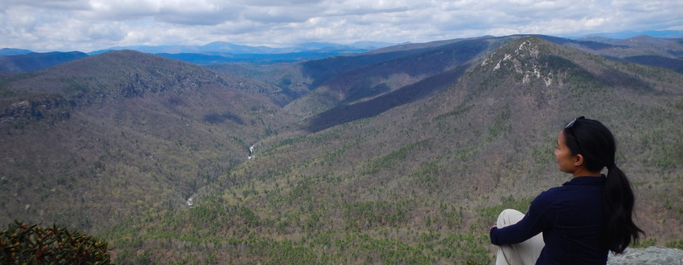
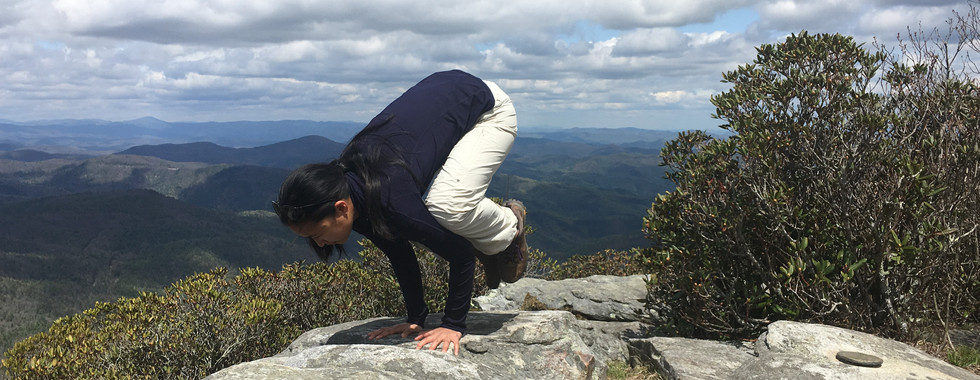
Once at the top, we could walk the flat, rocky ridge line. There were breath taking views in all directions as far as the eye could see. Even though it was hot on the way up, I needed to add an extra layer at the top because of the wind and change in elevation. We had so much fun balancing on all the rocks and checking out all the off chutes, or what I like to think of as secret paths. However after we kept going down the mountain, following the path of the runoff, I decided it was better to go back to the car on the marked trail instead of take another "Tom Shortcut". (The last time we did one of those, it took an hour longer to get to where we were going.) After all the exploring was done, we headed back the way we came and drove onto the next adventure.


Comments